 Tweet
Tweet
Originally posted by motoman
View Post
-
Not sure of hard numbers, but I heard yesterday morning that 1/3 of all aerial firefighting equipment in the US is now in Colorado. Biggest problem is going to be water as snow fall was really low this year, rainfall almost non-existent to this point and lakes/reservoirs are all way down. -
If the fire gets over Horestooth resevoir, the house I grew up in is about 3/4 of a mile east of it.Comment
-
Wow ... first I'd heard of this. I always drive 287 out of Ft. Collin's when I go camping in Medicine Bow National Forest.DamonHComment
-
my girls parents have a home their and they said it is getting very close. some friends of theirs lost their homes.Originally posted by 80coupe View PostComment
-
As many as they can get. There is a company out of Rockwall that just contacted me to try and get me to come fuel their Helicopter on returns as they are fighting this fire for $500/day plus expenses but had to pass. They are using every resource they can get their hands on.Originally posted by motoman View PostComment
-
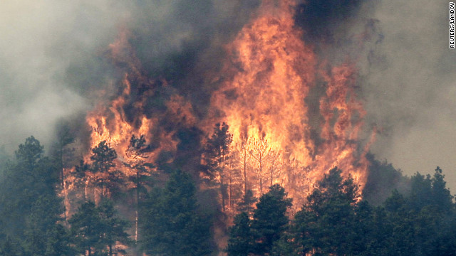
43,433 acres now and 5% contained. Could be 10% by end of day. 500 personnel now.
•Approx. 70% private land / 30% US Forest Service land
•Air resources for today:
- 5 Heavy air tankers
- 5 Single engine air tankers
- 4 Type 1 heavy helicopters
- 3 Type 2 medium helicopters
- 4 Type 3 helicopters
- 3 Blackhawk helicopters from the National Guard
•Ground resources for today:
- 500 firefighters
- 26 Engines (a surge is coming, 100 engines expected by the end of the day.


Comment
-
Drove up last night and the winds had slowed progression drastically. Started in Loveland and drove north to Laporte where the fire was larger, but seemed fairly calm - no giant flames, aggressive track, and so forth. May try to head back up today to get some pics.Comment
-
Hope everyone gets out of the way and I hope the firefighters stay safe and this doesn't claim anyone.Comment
-
1 death as of yesterday from someone that didn't evacuate.Comment
-
I will be going up to Ruidoso Saturday for an 8 day vacation so hope things improve. Looks like they made good progress yesterday and today due to low winds and higher humidity.Originally posted by 80coupe View PostComment
-
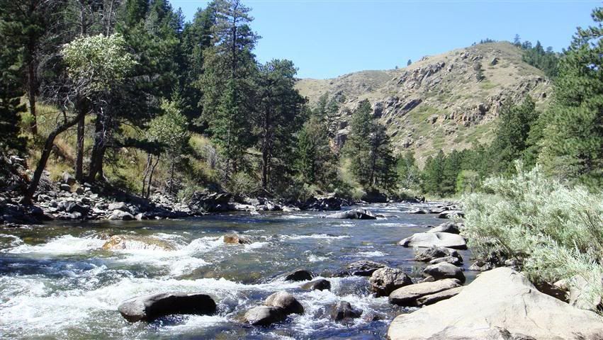
Not that anyone but Sean really cares, but it's up to 52,068 acres now, 15% contained, and 1,236 personnel working on it.
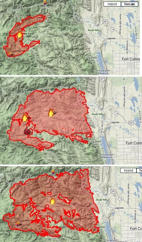


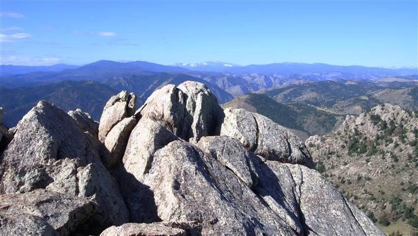
This pic is from the top of Greyrock exactly one year ago looking SW toward what is now on fire. We're going to try to get back up there next weekend... wondering what it looks like now.
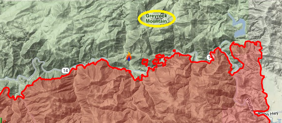
The Poudre River / Poudre Canyon is acting as the northern boundary for the fire (for the most part) right now, save for a few jumps. All of this is probably very crispy right now
Comment
-
We tried to access national forest via CO 14 (Poudre Canyon Rd) which was shut down. Took 287 to Livermore (flames visible from here) and took 74e towards red feathers lakes area. We managed to get onto 68c only because they hadn't evacuated yet and were able to drive to the back side of CO 14 right beyond the road block.
National Guard was everywhere. Is it customary for these guys to be assholes? It felt like a scene of of Outbreak. Anyway, got to some 4x4 trails and went in a little ways but the smoke was pretty thick and we were still probably 2-3 miles from flames. Ash was falling on us and at roughly 3:00pm it looked like the sun was down. At least the progression has slowed down, but they need to get more aggressive on the north side.
It looks like it started near La Porte by lightning strike as just a meadow fire that went apeshit.Comment
-
Doesn't help that they are having some sort of rare beetle infestation or something that is killing the trees. I was up in Colorado last summer and you could just see patches of dead trees everywhere. You can see them In some of these picturesComment
-
Originally posted by Danny46 View Post
Some of the areas burned already were over 70% beetle-killed trees. If nothing else the fire will definitely be good for killing some of those fuckers.
Firefighters are alarmed by a spot fire — about 100 acres — north of the Poudre Canyon, incident commander Bill Hahnenberg said Friday morning. If unchecked, the spot fire could gain momentum and make a run at Glacier View.
"We're working hard on the spot fire across the Poudre Canyon," Hahnenberg said. "Mother Nature is being very difficult. "
The terrain in the area is extreme, including numerous steep pitches and gullies, and fire fuels are abundant, including large patches of beetle-killed timber.Comment
-
Looks like rain moving in at the moment.Comment


Comment