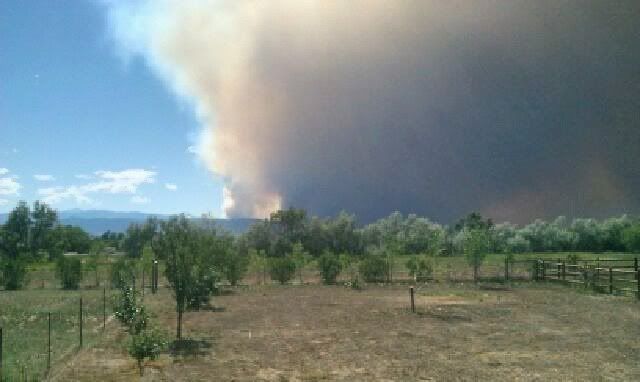
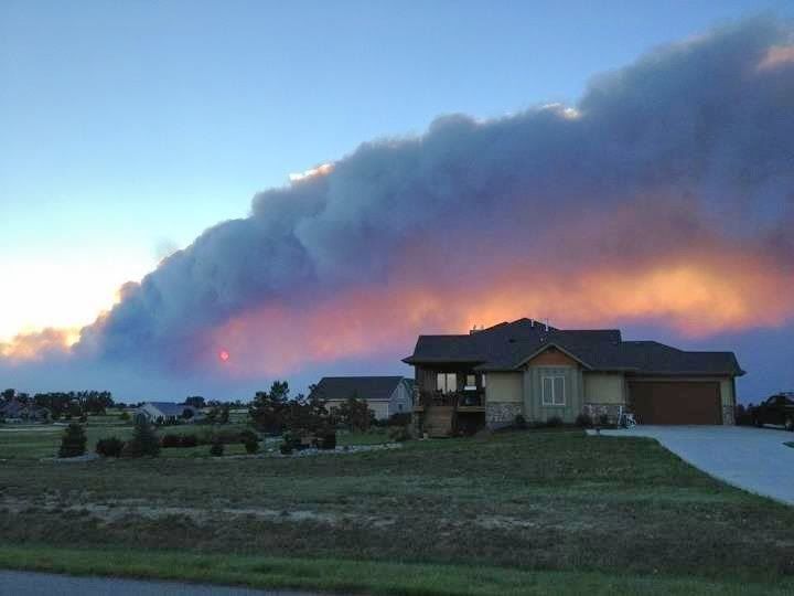
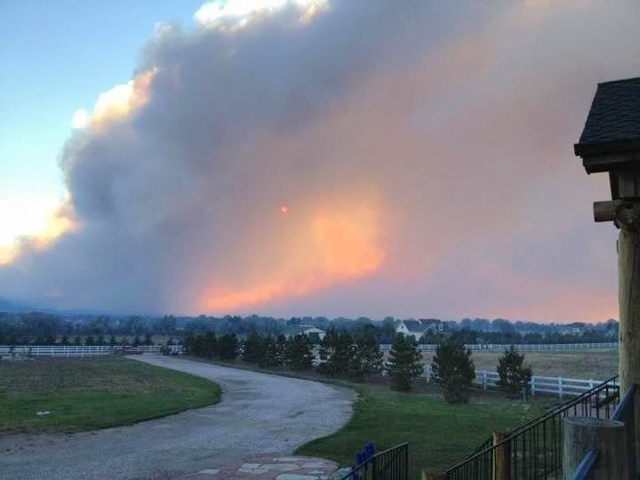
Got these pics from a friend in Fort Collins yesterday. This fire started Saturday morning (looks like a nature caused start so far). They were out golfing and saw the first plume come up in the front range and since then they have just watched it get bigger and bigger.
Note from Saturday:
Zero containment, 90*F temps, high winds, and a dry spring. Expectations are for 100,000+ acres, which would make it the biggest in that area in decades.
These are pics from his house just off the front range on the east side of FoCo.
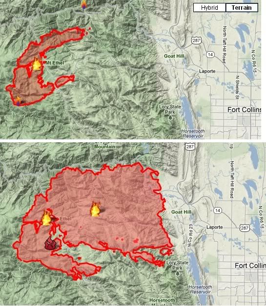
6am Saturday morning it was 2 acres.
10pm Saturday is was 8,000 acres.
The first estimate this morning was 20,000 acres, but the latest number is 36,930 acres with zero containment.
For reference Boulder, CO is 24 sq miles and Denver is 44 sq miles.

We're going to go hike through the burned up area in a couple weeks and check it out... I'll update with pics later.
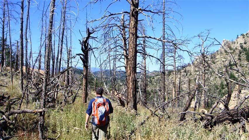
Last time we went up Grey Rock we went through part of the area burned by the 2004 Table Rock fire. This is what is looked like 7 years after.
Note from Saturday:
To say the fire exhibited extreme fire behavior overnight would not be giving the fire enough credit. Several very experienced firefighters have said the fire’s spread and behavior Saturday night and early Sunday were incredible. Typically a fire will lay down at night, moving much more slowly, but as a cold front passed through the area during the night the winds increased and shifted 45 degrees in direction, WSW to WNW. When the fire was mapped at 10:30 p.m. Saturday night by an infrared aircraft it was 7,400 acres. The MODIS satellite data shown in the map above captured the location of the heat at 3:20 a.m., and unless it was registering the heat in the smoke plume in addition to heat on the ground (which has happened in the past with infrared equipment on fixed wing aircraft when a fire was exhibiting extreme fire behavior), the fire more than doubled in size during that 5-hour period and ran approximately 6 miles. It will be very interesting to see a new fire perimeter after aircraft map it today with GPS equipment.
Zero containment, 90*F temps, high winds, and a dry spring. Expectations are for 100,000+ acres, which would make it the biggest in that area in decades.
These are pics from his house just off the front range on the east side of FoCo.
6am Saturday morning it was 2 acres.
10pm Saturday is was 8,000 acres.
The first estimate this morning was 20,000 acres, but the latest number is 36,930 acres with zero containment.
For reference Boulder, CO is 24 sq miles and Denver is 44 sq miles.


We're going to go hike through the burned up area in a couple weeks and check it out... I'll update with pics later.
Last time we went up Grey Rock we went through part of the area burned by the 2004 Table Rock fire. This is what is looked like 7 years after.




Comment